Blue Ridge Mountains hiking begins with understanding what you’re walking on — because these mountains have a story that reframes every trail you take through them. The Blue Ridge are among the oldest mountain ranges on earth, formed over a billion years ago when tectonic plates collided and pushed ancient ocean sediments into peaks that once rivaled the Himalayas. Time, water, and wind have worn them down to the rounded ridges and grassy balds visible today — but what looks gentle on the surface is underlain by some of the oldest exposed rock in North America. The characteristic blue haze that gives the range its name isn’t fog or pollution: it’s isoprene released by the billions of trees covering the slopes, a natural hydrocarbon that scatters blue light and has colored these mountains for millennia.
 What that ancient geology means practically for hikers: exceptional biodiversity (over 1,600 plant species across the range), dramatic elevation changes within short distances, and a landscape that offers everything from roadside waterfall walks to sustained ridgeline hikes above 6,000 feet — often within the same day’s drive. The Blue Ridge Mountains in western North Carolina offer some of the best hiking on the East Coast, with the Blue Ridge Parkway serving as the organizing spine and Pisgah National Forest spreading across 500,000 acres on either side.
Blue Ridge Mountains Hiking — At a Glance
Age of the Blue Ridge: Over 1 billion years old — second oldest mountain range on earth
Range extent: 550 miles from southern Pennsylvania to northern Georgia · 8 states
Highest peak: Mount Mitchell — 6,684 ft · Highest point east of the Mississippi
Blue Ridge Parkway: 469 miles · America’s most visited unit of the National Park system
Pisgah National Forest: 500,000+ acres · Four ranger districts · Hundreds of miles of trails
The blue haze: Isoprene released by trees — not pollution · A natural optical phenomenon
Best hiking base near Asheville: Blue Ridge Parkway enters Asheville at MP 382.6 via US-70
Permits required: None for hiking on National Forest or Parkway trails
Best seasons: Spring (wildflowers) · Fall (foliage) · Winter (solitude, ice, clarity)
The Blue Ridge Mountains — What Makes This Range Extraordinary
 The Blue Ridge Mountains span eight states and 550 miles, but western North Carolina is where the range reaches its most dramatic expression. The highest peak east of the Mississippi River — Mount Mitchell at 6,684 feet — rises from the Black Mountains, a spur of the Blue Ridge just north of Asheville. Forty mountains in North Carolina exceed 6,000 feet. The Blue Ridge Parkway, threading south from Asheville through the Pisgah district toward the Smokies, passes through some of the most concentrated high-elevation scenery in the eastern United States.
The geology explains why. The Blue Ridge Escarpment — the sharp eastern drop from the mountain plateau to the Piedmont — creates some of the most abrupt elevation changes in the eastern US. Streams running off the plateau drop thousands of feet in short distances, creating the waterfall density that makes Transylvania County alone home to over 250 named falls. The same escarpment drives orographic rainfall: moist air from the Gulf of Mexico hits the Blue Ridge front and rises, cools, and releases precipitation that averages over 90 inches annually in some western NC counties. Water is everywhere in these mountains, and it falls fast.
For hikers, the practical consequence is a landscape that can take you from lush creek-bottom forest to open alpine bald in a single morning — with waterfalls, rhododendron tunnels, and ridge-top wildflower meadows between.
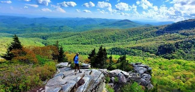
Best Blue Ridge Mountains Hiking — High Elevation Balds
The high-elevation balds of western NC are the defining feature of Blue Ridge Mountains hiking — open, treeless summits above 5,000–6,000 feet that offer the kind of panoramic views normally associated with mountains twice the size. Several of the best are clustered along the Blue Ridge Parkway south of Asheville.

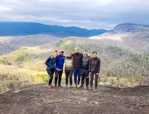
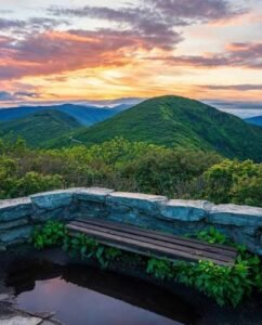 One of the most famous catawba rhododendron displays in the entire Appalachian range erupts each June at Craggy Gardens, just north of Asheville on the Blue Ridge Parkway. The Pinnacle Trail climbs 1.4 miles round-trip from the visitor center at MP 364.1 to panoramic views at 5,640 feet. Mid-to-late June is peak bloom — a tunnel of deep purple-pink that transforms the approach trail into something that barely looks real. Come any other season and the high-elevation bald character and ridge views make it equally worthwhile. The shortest significant high-elevation hike on the north side of Asheville and one of the most accessible summit experiences in Blue Ridge Mountains hiking.
Exploring the Blue Ridge Mountains? Windows Over Waterfalls is private waterfall cabin 1 hour from Asheville — 15 minutes from Max Patch. Check Availability →
Best Blue Ridge Mountains Hiking — Waterfall Trails
The waterfalls of western NC’s Blue Ridge are the direct consequence of the geological story told above: an escarpment creating rapid elevation loss, and rainfall rates that keep those streams running year-round. The US-276 corridor through Pisgah National Forest south of Brevard is the most concentrated waterfall corridor in the range.
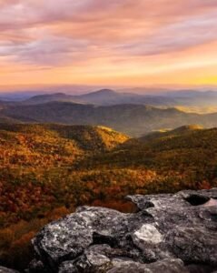
 Graveyard Fields combines two waterfalls, a mile-high highland meadow, wild blueberries, and the best fall foliage timing on the Parkway in a single 3.2-mile loop. The area sits at MP 418.8 in a natural bowl between 6,000-foot peaks — named for the moss-covered stumps that once resembled grave markers after a catastrophic windstorm toppled the original forest. A fire in 1925 burned the logged area; the high-altitude meadow has been recovering ever since, creating an open, otherworldly valley unlike anything else in Blue Ridge Mountains hiking. Lower Falls (55 ft) is just 0.3 miles from the parking area and accessible to nearly anyone. Upper Falls is 1.5 miles in with more elevation. Restrooms at the trailhead. Fall color arrives here in mid-September — among the first spots in the NC Blue Ridge to turn. See our
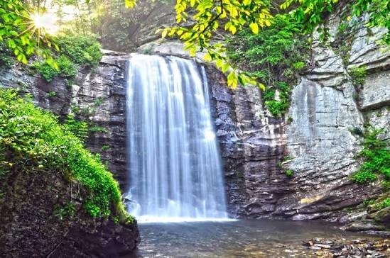
Seasonal Guide to Blue Ridge Mountains Hiking
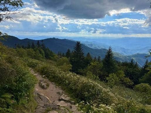
Spring (March–May): The Blue Ridge comes alive from the valley floor up. Wildflowers sequence from elevation to elevation — trout lily and bloodroot on the valley floors in March, then trillium and wild geranium in April, then catawba rhododendron and flame azalea on the high balds in late May. Waterfalls run at peak volume. The Appalachian Trail sees peak northbound thru-hiker traffic. Mud on high-elevation trails can be significant in early spring.
Summer (June–August): Craggy Gardens rhododendron peaks in mid-to-late June — one of the most extraordinary natural events in Blue Ridge Mountains hiking. Black Balsam and the high balds hit peak wildflower in July and August. Summit temperatures run 15–20 degrees cooler than the valleys. Afternoon thunderstorms build most days — be off exposed ridges by early afternoon. Popular trailheads fill by 9–10am on weekends.
Fall (mid-September–November): The defining Blue Ridge Mountains hiking season. Graveyard Fields and the high balds turn in mid-September; the lower elevations and river corridors follow through October. The combination of foliage framing waterfalls, crystal-clear air, and long-range ridge views makes this the most photographed and most visited season. Book lodging well in advance for October weekends.
Winter (December–March): The most underrated season for Blue Ridge Mountains hiking. Looking Glass Rock Trail loses 90% of its crowds. Black Balsam gets snow and ice — crampons or microspikes required. Max Patch in fresh snow is among the most stunning landscapes in the southern Appalachians. The Blue Ridge Parkway closes in sections during ice events; check nps.gov/blri before driving. The views in January and February are the clearest of the year — no haze, no humidity, just pure mountain light.
The Appalachian Trail Through the Blue Ridge
The Appalachian Trail threads through the Blue Ridge Mountains for most of its 2,190-mile length from Georgia to Maine — and western North Carolina contains some of its most celebrated sections. The AT enters North Carolina near the Georgia border at Springer Mountain and traverses the southern Appalachians through the Smokies before emerging at Max Patch and continuing north through Hot Springs.
Hot Springs, North Carolina is the only town in the state where the Appalachian Trail runs directly through downtown — past the restaurants on Bridge Street, across the French Broad River, and up into the mountains on both sides. It’s a genuine AT trail town, with a long history of welcoming thru-hikers who stop to soak at the mineral springs before continuing north. The AT corridor from Max Patch south to the Smokies and north toward Roan Mountain represents some of the finest Blue Ridge Mountains hiking anywhere on the trail. For everything to do in Hot Springs between trail days, see our Hot Springs NC guide.
Where to Stay for Blue Ridge Mountains Hiking
Asheville is the natural hub for Blue Ridge Mountains hiking — centrally located, with easy Parkway access both north and south, and Pisgah National Forest within 40 minutes. For a complete guide to the best hikes from Asheville organized by difficulty and location, see our Asheville NC hiking guide.
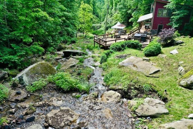
For hikers focused on the northern Blue Ridge — Max Patch, the AT through Hot Springs, the Laurel River Trail, and the Craggy Gardens corridor — staying north of Asheville cuts drive times and puts you in a more immersive mountain setting. Windows Over Waterfalls is a private waterfall cabin one hour north of Asheville in the mountains above Hot Springs — 15 minutes from Max Patch, 20 minutes from the Hot Springs AT trailhead. Four secluded acres in Pisgah National Forest country, with multiple waterfalls running the full length of the property, a hot tub above the creek, 38 windows and skylights, and two fire pits. One booking at a time. No other guests. Book direct at windowsoverwaterfalls.com.
Airbnb designates this as a top 10% home — their designation, not ours · Guest Favorite · Superhost
What Airbnb Guests Are Saying
★ 4.97
243 Five-Star Reviews
243 Reasons to Book With Confidence
As of June 2026 — and still growing.
After a day on the Blue Ridge Mountains trails, the Hot Springs Resort and Spa offers private mineral spring soaking tubs at 102–103°F on the banks of the French Broad River — the only public hot springs east of the Mississippi. The combination of a Blue Ridge Mountains hiking day and an evening mineral soak is the most-recommended recovery plan in Madison County.
Planning a Wedding or Elopement in the Blue Ridge Mountains?
The same property hosts private waterfall ceremonies through our sister site — all-inclusive elopement packages from $4,400 with photography, florals, officiant, hair & makeup, and more.


