 The Appalachian Trail in Hot Springs NC runs directly through the center of town — past the restaurants, across the French Broad River, and up into the mountains on both sides. Hot Springs is the only town in North Carolina where the AT travels through the heart of downtown, which makes it one of the most accessible and distinctive trail towns on the entire 2,190-mile route. Whether you’re a thru-hiker resupplying, a day hiker looking for views, or someone who just wants a morning walk with something to look at, the trails here deliver.
The Appalachian Trail Hot Springs NC Passes Through Town
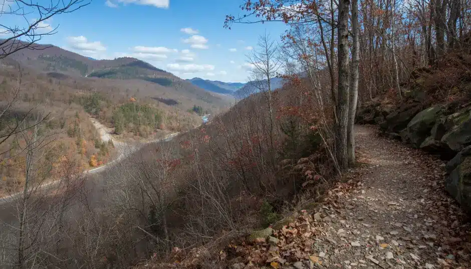
 The AT enters Hot Springs from the south at the base of Deer Park Mountain and follows Bridge Street through town for about a mile — past the restaurants, the outfitters, and the Hot Springs Resort & Spa — before crossing the French Broad River and climbing north toward Lovers Leap. Granite markers embedded in the sidewalk mark the trail route through town, a detail that makes Hot Springs feel unlike any other trail town. Over 2,000 thru-hikers pass through annually, mostly northbound between March and May.
For section hikers, the stretch from Hot Springs to Max Patch is one of the most popular on the southern AT — 19 miles of ridge walking with 360-degree summit views at the end. AllTrails rates it as a challenging point-to-point with highlights including stunning views at Max Patch, abundant camping spots just off the bald, and blooming mountain laurel in season. Steep climbs and limited water sources are the main challenges. Starting early and planning for an overnight stay are recommended for the full stretch.
The shorter southbound section from Garenflo Gap to Hot Springs is 7.4 miles, generally wooded with some nice vistas, and passes the Deer Park Mountain Shelter at the 3-mile mark — a good lunch stop with a spring/creek nearby. AllTrails reviewers rate it as moderately challenging, with a steep 1,000-foot ascent in the first mile and a long gradual descent into town at the end.
One note worth knowing: the AT through this section was significantly impacted by Hurricane Helene in late 2024. Volunteers have done substantial trail clearing work and the AT through Hot Springs is fully open, but conditions on some backcountry sections may still vary. Check appalachiantrail.org for current trail conditions before heading out on any multi-day section.
Lovers Leap Loop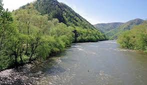
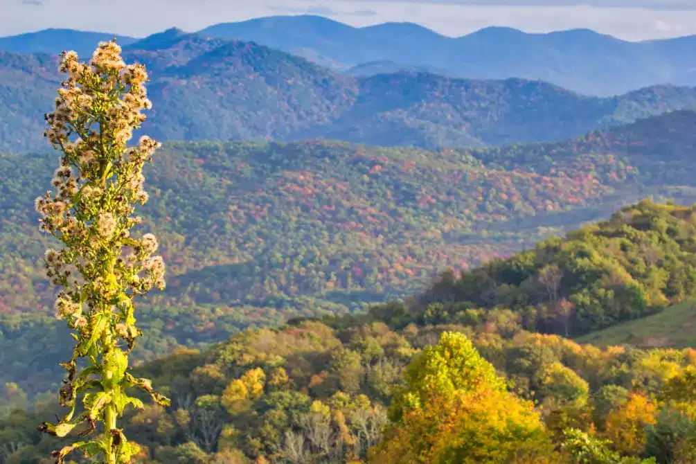
The most iconic short hike from Hot Springs and one of the best day hikes in all of Madison County. The Lovers Leap Loop is a 1.6-mile circuit that combines the Appalachian Trail and the Lover’s Leap Trail (#308), starting from the Silvermine Trailhead just across the French Broad River from downtown. AllTrails rates it as moderately challenging with 429 feet of elevation gain and an average completion time of 55 minutes — though most visitors take longer to enjoy the views. It’s one of the most accessible hikes on the Appalachian Trail Hot Springs NC section.
The route follows the AT along the French Broad River past rocky outcrops and a wide whitewater waterfall at the 0.35-mile mark, then climbs steeply to the Lovers Leap ridge. At the top, rock outcroppings offer panoramic views of the French Broad River valley, the town of Hot Springs below, and the surrounding Pisgah National Forest ridgeline. The Appalachian Trail Conservancy describes it as offering “a dramatic view of the town and French Broad River” and notes you can watch for Canada Geese on the river, and hawks and eagles overhead. The French Broad is one of the oldest rivers in the world, likely formed before the Appalachian Mountains themselves — context that makes the view hit differently.
Tripadvisor reviewers consistently single out the summit view. One wrote: “GREAT view of Hot Springs — my picture doesn’t do it justice. Saw an eagle and that was AWESOME.” Another noted the Pump Gap extension for an extra challenge but cautioned it may not be suitable for small children. Most reviewers recommend hiking counterclockwise and using trekking poles on the steep descent. One important safety note from Explore Asheville: stay away from the rocky cliff edges at the summit — the drop is fatal. The views are worth it; the edge is not.
Trailhead: Silvermine Trailhead, Hot Springs — park along Andrews Avenue, just across the French Broad from downtown. Free parking. Dog friendly on leash. Open year-round.
 Laurel River Trail
The counterpoint to Lovers Leap and the perfect second-day hike for anyone exploring the Appalachian Trail Hot Springs NC area — flat, easy, and completely different in character. The Laurel River Trail is a 7.3-mile out-and-back through Pisgah National Forest along the Big Laurel Creek, built on the bed of an old railroad that once connected the riverside hamlet of Runion to the outside world. AllTrails rates it easy, with 341 feet of total elevation gain and an average completion time of about 2.5 hours. You don’t have to hike the full distance — it’s the kind of trail you go as far as you feel like and turn around.
The trail starts on a gravel road through private property for the first mile before entering national forest land, where it narrows and the creek comes into full view. Whitewater rapids, trout pools, swimming holes, and massive boulders line the route. WNC Magazine describes it as “joyous for nature lovers” in early spring when wildflowers bloom — bloodroot, trillium, bleeding heart — and the rhododendrons form tunnels over the trail in late May and early June. About three-quarters of the way in, foundational ruins from the old town of Runion appear trailside. Tripadvisor reviewers note the kayaks running the rapids alongside the trail in summer, the excellent swimming holes, and the overall ease of the hike. One reviewer described it as: “relatively flat, pretty easy hike — the Laurel River runs beside it the whole way. Wildflowers galore in the spring and the rhododendrons make a tunnel while in bloom. I highly recommend this easy hike.”
Explore Asheville describes it as family-friendly enough for small children and recommends combining it with a visit to Hot Springs just 10 minutes away for a full-day outing. Dogs welcome on leash. Mountain biking and fishing also allowed.
Trailhead: Intersection of US 25/70 and NC-208, about 10 minutes from Hot Springs. Gravel parking area on the south side of the intersection. Parking fills on nice weekend days — go early or late afternoon.
Max Patch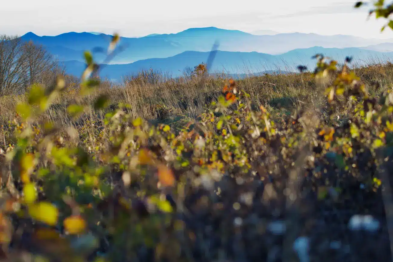
Fifteen minutes from Windows Over Waterfalls, Max Patch is one of the most photographed summits on the entire Appalachian Trail. A 4,629-foot bald with 360-degree views across the Blue Ridge, Black Mountain, and Great Smoky Mountain ranges — no trees blocking the sight lines, just open grassy summit and sky in every direction. The standard hike to the summit is a 1.4-mile loop from the Max Patch trailhead on Forest Road 1182 with about 300 feet of elevation gain. The views are immediate and the hike is accessible to most fitness levels.
Sunrise and sunset visits are particularly popular — the summit is exposed and the light can be extraordinary. Come prepared for wind regardless of season; temperatures at the summit run significantly colder than in the valley. Parking at the Max Patch lot fills early on weekends, especially in fall foliage season. recreation.gov parking reservations are required on peak days — check before you go.
Where to Stay for Hot Springs NC Hiking
The Appalachian Trail Hot Springs NC and the surrounding trails are best experienced over more than a day — there’s enough here to keep you busy for a full weekend and still leave trails unhiked. Windows Over Waterfalls is a private waterfall cabin 20 minutes from Hot Springs and just five miles down the road from Max Patch — 4 secluded acres with a mile of private hiking trails on property, waterfalls running the length of the creek, and a hot tub above the water for when you’re done. One booking at a time. Book direct at windowsoverwaterfalls.com — no platform fees.
15 minutes from Max Patch and from the AT trailhead. Book Direct →
Practical Notes for Hiking Near Hot Springs NC
The Appalachian Trail Hot Springs NC section is well-marked but cell service is limited throughout this area — download offline maps on AllTrails or Gaia GPS before leaving the main road. Parking at popular trailheads like Max Patch and Lovers Leap fills on weekends, particularly in fall. The trails here are open year-round but winter conditions can make the steeper sections slippery — trekking poles are worth having for Lovers Leap and any AT section hiking. Hurricane Helene caused significant damage to trails and forest in this area in late 2024; most trails are open but verify conditions at AllTrails or appalachiantrail.org before any backcountry outing.
Planning a Wedding or Elopement on the Trail?
The same property hosts private waterfall ceremonies through our sister site — all-inclusive packages from $4,400 with photography, florals, officiant, and more.


